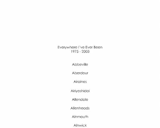
2015
Heatscapes
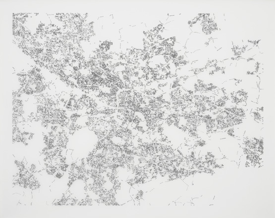
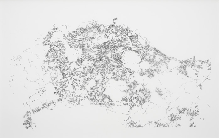
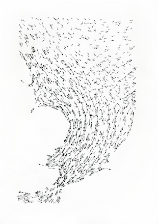
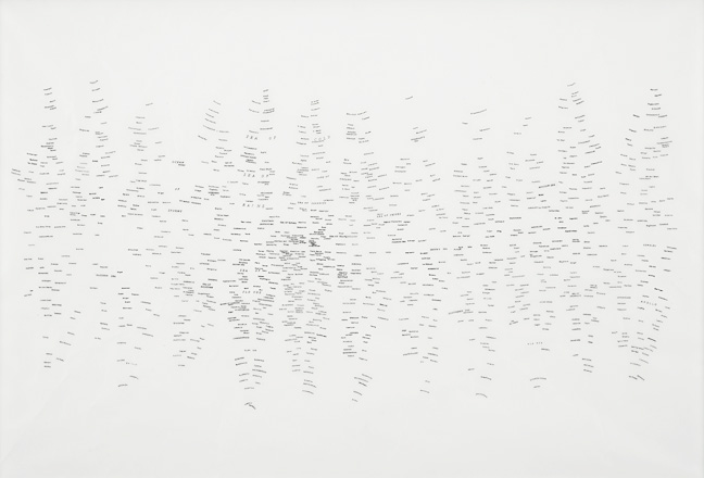
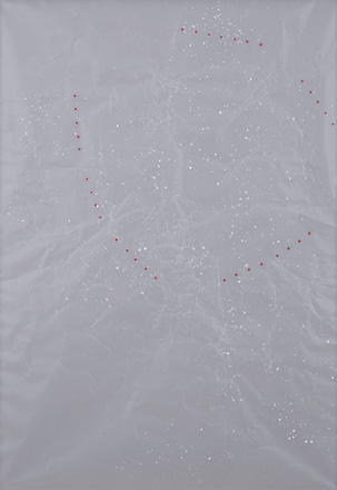
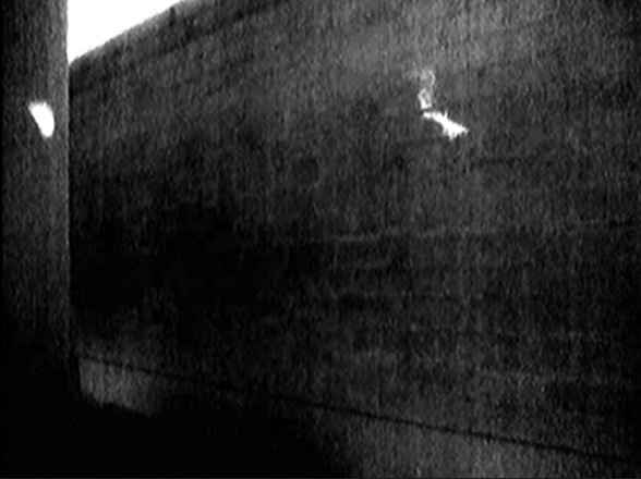
Filmed entirely using thermal imaging cameras at last year’s Great North Run, Heatscapes is a series of short films that trace the race participants' journeys across the cityscape. The cameras make visible the glowing heat generated by the runners' bodies during their training, warm up and the race itself, and reveal the temporary heat prints transferred from the runners onto the urban fabric as they move through the city.
Heatscapes will premiere at The Gallery, Tyneside Cinema where the artist has conceived a multi-screen installation specifically for The Gallery, transforming the space via multiple projections.
Heatscapes is a Great North Run Culture Moving Image Commission.
Trespass
Trespass is available on App Store.
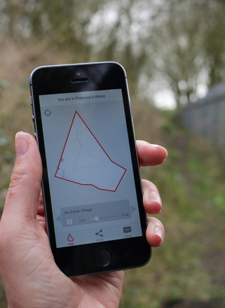
Trespass is an app for iphone that provides users with an oral history of Freeman’s Wood; an area of urban edgeland situated on the outskirts of Lancaster, England.
Freeman's Wood has been used for decades by local people for recreation and is currently owned by an offshore property company. Recently they erected a metal fence around the Wood, barring locals from entering under threat of breaking trespass laws.
Curtis recorded interviews with members of the local community as they walked inside and around the Wood. App users are invited to walk these same routes whilst listening to the individuals reflect on the impact the Wood has had on their lives, and their speculations as to what the Wood’s future might be.
The app uses geo-location to identify where users are in relation to the boundary of Freeman’s Wood. The app restricts access to some of the audio content - access to all thirteen audio tracks is only granted if the listener chooses to trespass, crossing both the physical fence, and the app’s virtual geo-fence, into Freeman’s Wood.
Click here to listen to a sample audio track
An essay by Andrew Brown accompanies the work. Related article for Guardian Cities by Bradley Garett.
Twitter: @Trespass_App
Facebook: Trespass Facebook page
#Trespass #FreemansWood
Trespass was commissioned by StoreyG2. App programmer Ron Herrema.
2014
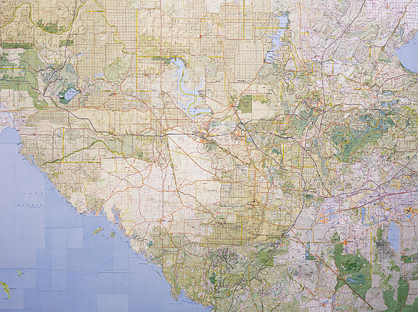
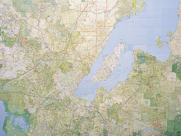
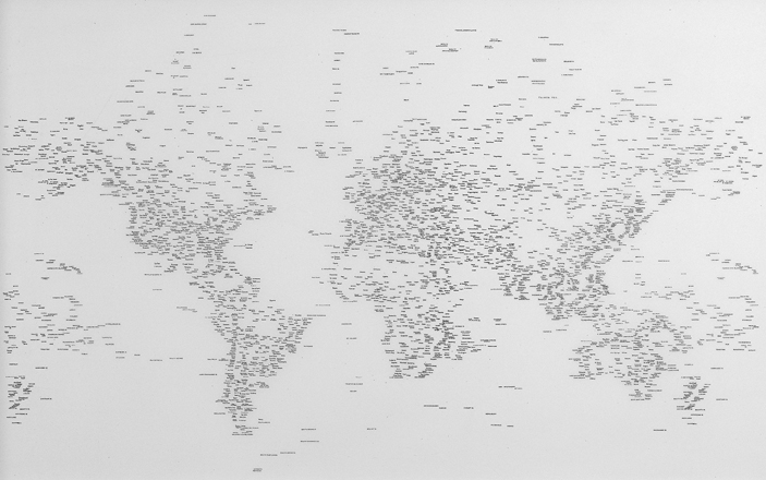
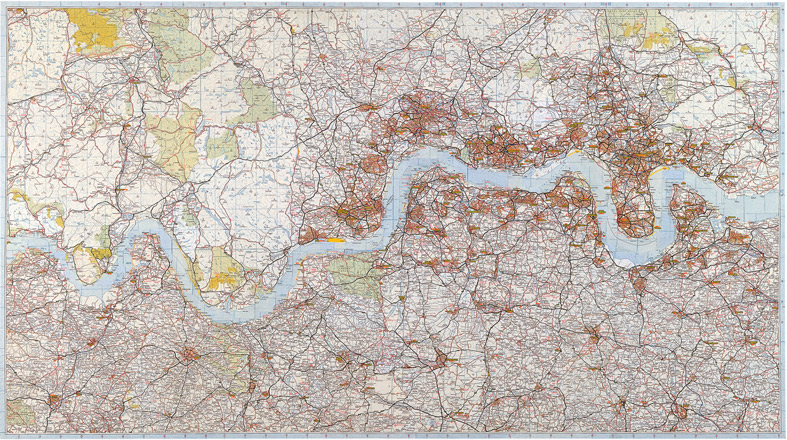
The Thames (Section 1: from London Bridge, Arizona to Salt Island, British Virgin Islands)
The first section of the ten-part collage The Thames (from London Bridge, Arizona, to Sheerness, Canada), (2013) is reproduced as a limited edition print to coincide with the Bridge exhibition at Museum of London Docklands.
Digital pigment print on Somerset Enhanced Velvet paper (255gsm). Dimensions 69.4 x 52cms (including 5cm border). Each print is signed and numbered. Edition of 80.
The Thames (Section 1: From London Bridge, Arizona to Salt Island, British Virgin Islands), 2014
Digital pigment print on Somerset Enhanced Velvet paper (255gsm). Edition of 80, 69.4 x 52cms
(dimensions include a 5cm border) (View Zoom)
2013
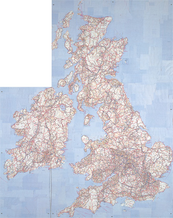
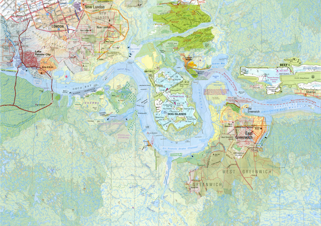
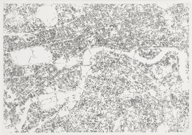
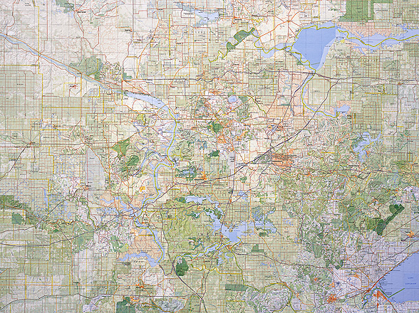
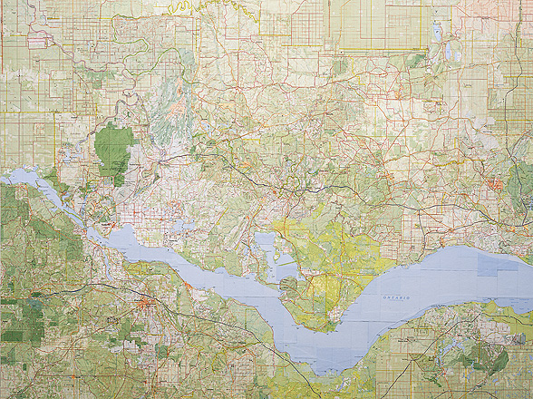
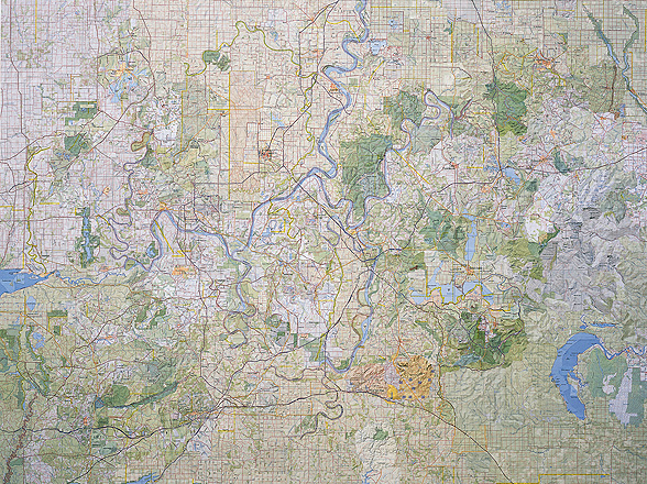
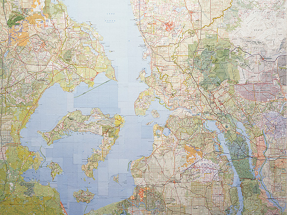
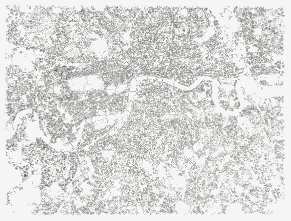
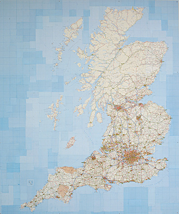
The Thames (from London Bridge, Arizona to Sheerness, Canada)
This ten-part collage examines place names along the shores of the River Thames, tracing their global namesakes and namegivers and revealing in the process many of the river's industrial and colonial histories.
Initially commissioned for the Thames Festival in 2013, it was exhibited on riverside walkways in front of Tate Modern and by Tower Bridge.
The first section of the ten-part collage is reproduced as a limited edition print to coincide with the Bridge exhibition at Museum of London Docklands.
Commissioned by The Cultureship for Thames Festival.
The Thames (from London Bridge, Arizona to Sheerness, Canada), 2013
Collaged maps, 30 x 42 cms
The Thames (Section 1: From London Bridge, Arizona to Salt Island, British Virgin Islands) (View Zoom)
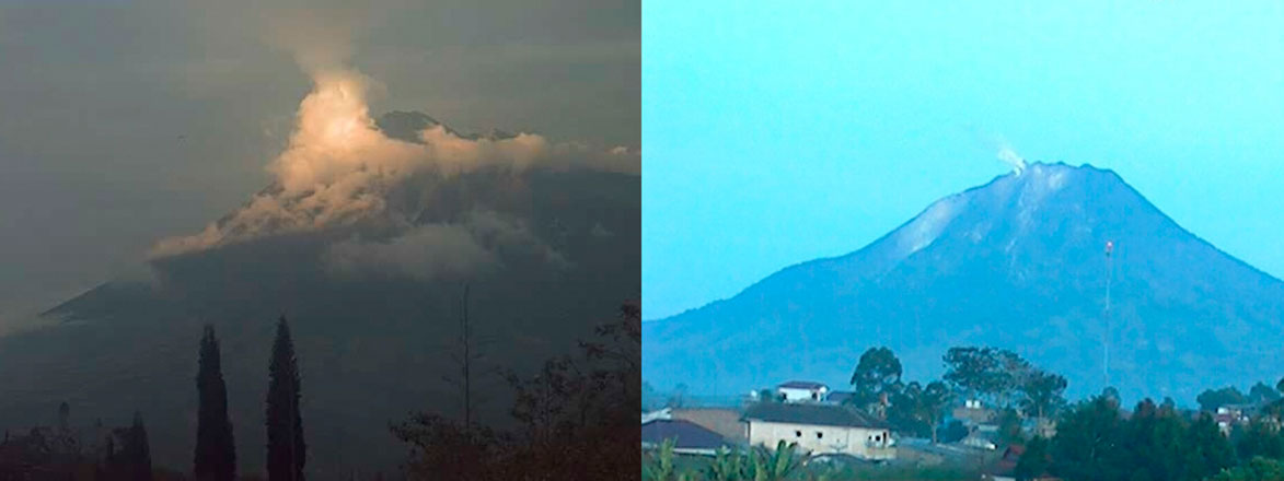
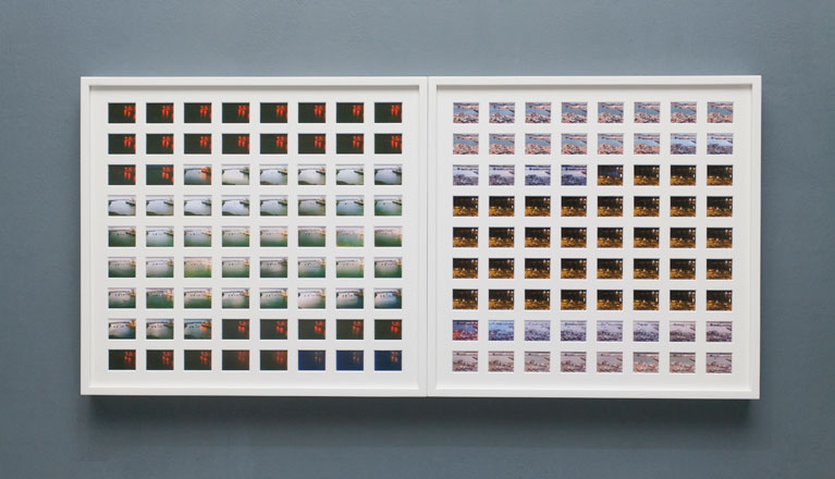
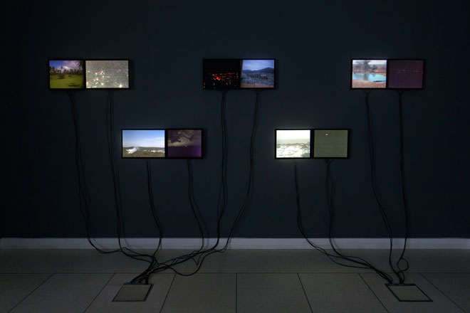
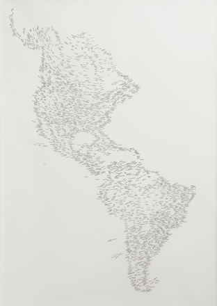
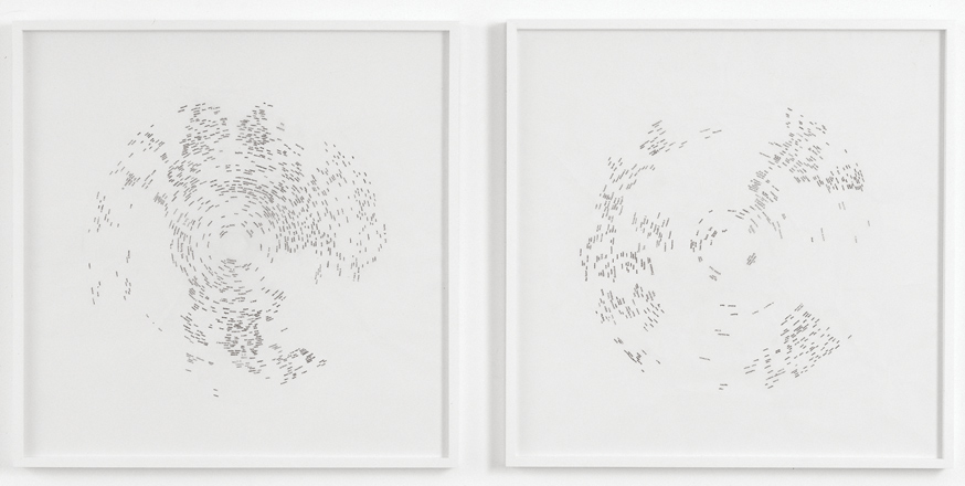
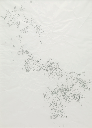
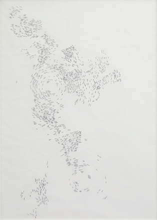
Antipodes
Antipodes is a constantly updating online artwork which pairs webcams images from places on exact opposite sides of the globe. As far away from each other as it is possible to be, these distant 'twins' often have surprising afinities.
Alongside the online artwork exists a series of time-lapse videos created from the continuous flow of images so far captured by the project website. Additionally an installation of live webcam feeds, drawings depicting antipodal geographies and photographic works have also been created from the collected data.
Antipodes launched on the Northward Equinox 2013 and will run for a period of one year: www.antipodes.uk.com
Commissioned by Film and Video Umbrella, in association with Spacex.
Antipodes (Dawn / Dusk), 2013
Digital C-Type print on aluminium
Antipodes (Volcán Tungurahua, Ecuador / Gunung Sinabung, Indonesia)
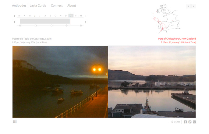
Antipodes (One Day), 2013
Two gicléé prints framed with window mounts
One Day (Puerto de Tapia de Casariego, Spain / Port of Christchurch, New Zealand)
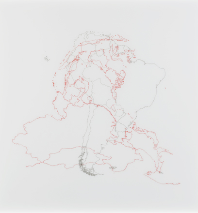
Antipodes (Antipodal Geographies), 2013
Ink on tracing paper, 50 x 50cms
Antipodes (South America / South East and East Asia) (View Zoom)
2012
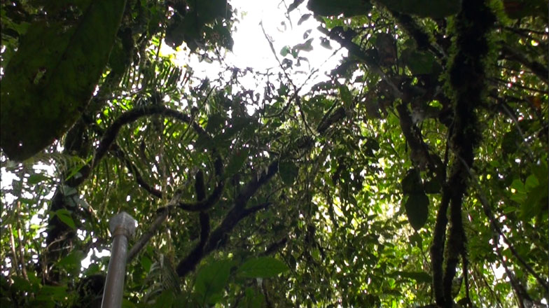
Tong Tana
Tong Tana captures a view of the Borneo rainforest from the perspective of a semi-nomadic Penan hunter as he traverses rugged jungle terrain - making solitary journeys through traditional hunting grounds with his handmade poison-arrow blowpipe.
The work was filmed using a head mounted camera and binaural microphones worn by the hunter. His journey is experienced as an immersive video installation, with binaural sound.
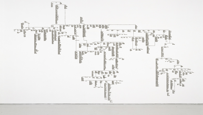
Tong Tana also includes a series of maps made in collaboration with the hunter that plot his route over several days.
The artist would like to thank The Penan of the Upper Baram River, Sarawak, Borneo for their generosity and hospitality.Tong Tana is supported by Arts Council England. Sound mastered by Craig Vear.
2011
2010
2009
2008
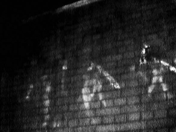
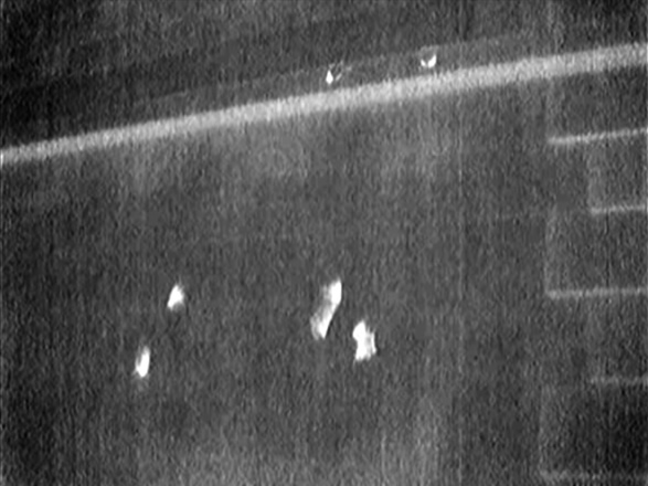
Traceurs: to trace, to draw,
to go fast
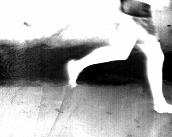
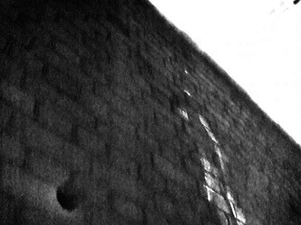
Traceurs: to trace, to draw, to go fast is a collection of twenty black and white films, created using a thermal imaging camera, which capture a series of moments in which traceurs (practitioners of parkour) come into physical contact with the urban fabric. The camera, which sees the world in terms of temperature rather than light, makes visible the glowing white heat residue transferred from hands, fingers and feet onto the surfaces that the traceurs nimbly leap onto, run across and spring off.
The films are screened simultaneously as part of a multi channel video installation.
Related publication: Traceurs: to trace, to draw, to go fast with essay by Richard Grayson
Commissioned by Westminster City Council.
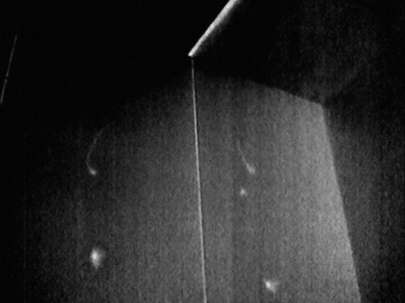
Wall Run (1), 2008
Digital video still handprinted in B/W, mounted on aluminium, unique, 100cms x 120cms
Cat Leap (5), 2008
Digital video still handprinted in B/W, mounted on aluminium, unique, 100cms x 120cms
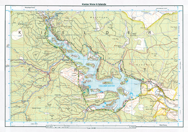
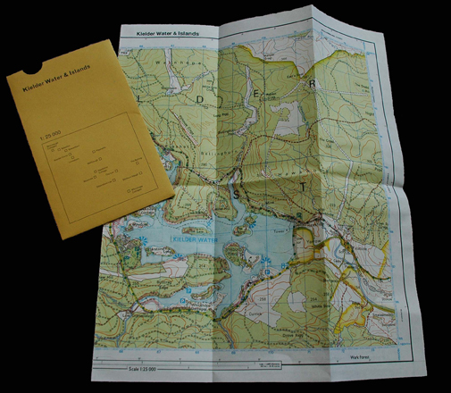
Kielder Water & Islands
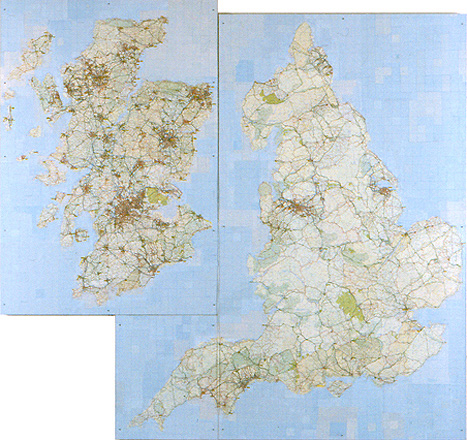
Kielder Water & Islands is a collaged map combining a contemporary map of Kielder Water with a map of the valley before it was dammed and flooded. On the new map a series of 'islands' are created from the 14 communities that existed before Kielder Water was opened in 1982.
Kielder Water & Islands was produced as an edition of 10,000 folded, printed maps with slipcase co-designed with Fraser Muggeridge studio and distributed free to visitors to Kielder Water & Forest Park.
Developed by The Kielder Partnership: The Calvert Trust, The Environment Agency, Forestry Commission, Northumberland County Council, Northumbrian Water, Tynedale Council & Community Groups.
2007
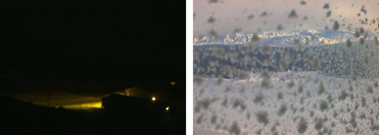
78 Degrees North, 67 Degrees South
Every minute for one year, the images transmitted from two webcams, each at opposite ends of the planet, were captured and compiled to create the timelapse work 78 Degrees North, 67 Degrees South.
Beginning on the southern hemisphere's longest day (and subsequently the northern hemisphere's shortest day), the two videos are viewed side by side tracking the contrasting seasons and extreme weather conditions at these diametrically opposite locations.
2006
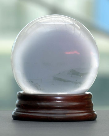
67 Degrees South
Real time images of the Antarctic landscape, transmitted from a live webcam installed at an Antarctic research station 67 degrees south, are projected onto a miniature screen inside a snowdome in the work 67 Degrees South.
67 Degrees South was commissioned by National Glass Centre on the occasion of the 2007 Sunderland Winter Festival.
Sky Drawings (Night,Day)
Sky Drawings (Night, Day) is a two channel video projection depicting the traces left by aeroplanes as they cross a particular section of sky. One projection shows lingering vapour trails gradually obliterating a blue cloudless sky, while the other shows a collection of red, green and white blinking aeroplane lights against the night's sky. Projected simultaneously onto a double sided screen the night and day footage cannot be seen at the same time.
Related publication: A Congregation of Vapours, with essay by David Barrett
Sky Drawings (Night, Day) was commissioned by VIVID and supported by the Henry Moore Foundation.
Sky Drawings (Night, Day), 2006
Two channel video installation,
colour, silent, 11 minutes 10 seconds
Installation view
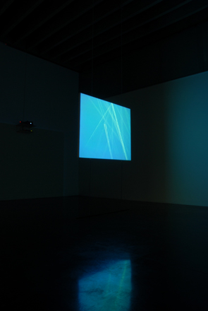
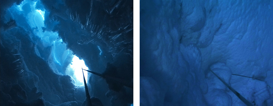
Crevasse
Crevasse is a two channel video installation depicting a gradual assent out of an Antarctic crevasse. The assent, captured simultaneously on two cameras (one downward facing and one upward facing), is replayed in the gallery space - the footage from the downward facing camera is projected onto the floor while the footage from the upward facing camera is projected onto ceiling.
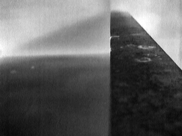
Horizon (Port, Starboard)
Horizon (Port, Starboard) is a two channel video projection depicting the moving horizon line filmed simultaneously from opposite sides of an ice-strengthened ship. As the ship propels forward and rolls from port to starboard the horizon rises and falls within the two window frames – one horizon falling exactly as the other rises.
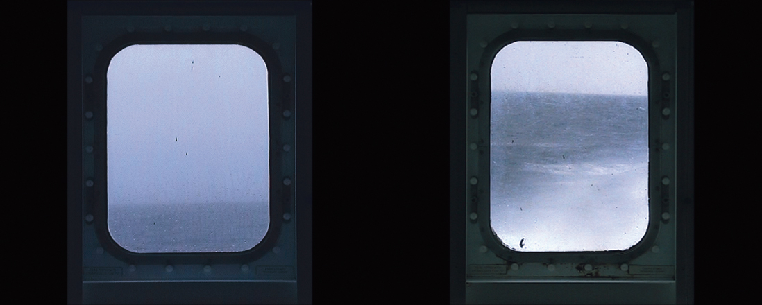
Horizon (Port, Starboard), 2006
Two channel video projection, colour, silent, 15 minutes 15 seconds
video still
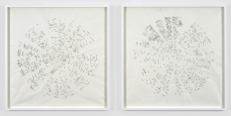
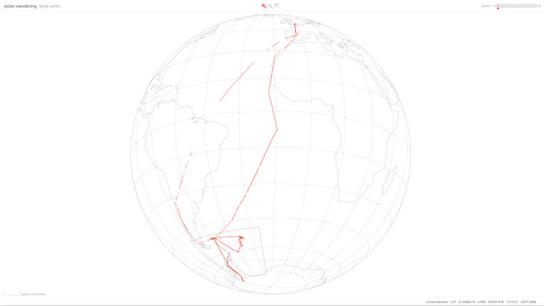
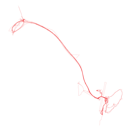
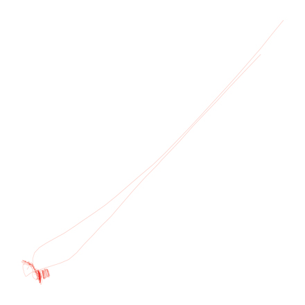
Polar Wandering
Layla Curtis spent three months in Antarctica carrying out an extensive psycho-geographical exploration and creating a continuous line drawing charting her journey.
Longitudinal and latitudinal data recorded on a personal GPS tracking system was logged on the project website to create a 27,856 mile long, interactive web based drawing embedded with photographs and drawings.
A suite of 10 limited edition screen prints, focusing on specific points and incidents along the line were also produced.
Layla Curtis was awarded an Arts Council England International Fellowship to Antarctica jointly sponsored by The British Antarctic Survey. This project was developed in collaboration with Locus+.
2005
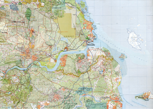
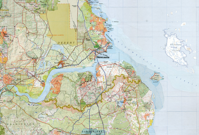
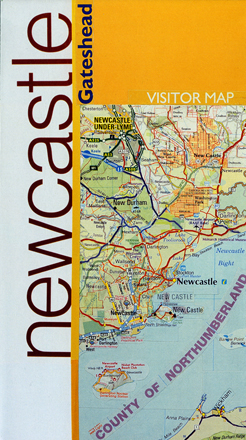
NewcastleGateshead
NewcastleGateshead is a collaged map complied from regional namesakes taken from city maps worldwide. Place names from a number of countries including Australia, Canada, Jamaica and Ireland are juxtaposed to create an alternative map of North East England.
30,000 copies of the double sided, folded print version of NewcastleGateshead were distributed free across the UK to coincide with NewcastleGateshead Festival of the Visual Arts 2006.
Additionally the collage was reproduced as a limited edition digital pigment print using archival inks on Somerset Enhanced Velvet paper (255gsm) Signed edition of 35.
Commissioned by Locus+
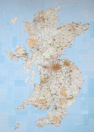
NewcastleGateshead, 2005
Collaged road and topographical maps, collage in two parts, 50cms x 70cms each
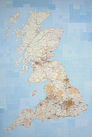
NewcastleGateshead, 2005
Digital pigment print using archival inks on Somerset Enhanced Velvet paper (255gsm), 60cms x 79cms
2004
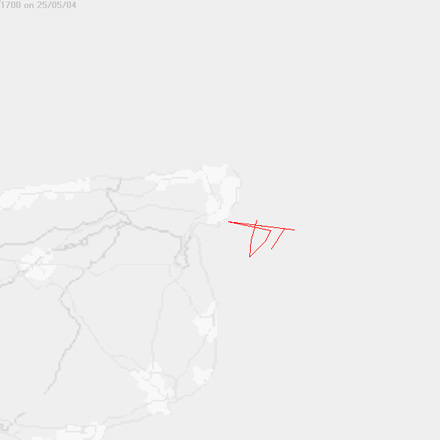
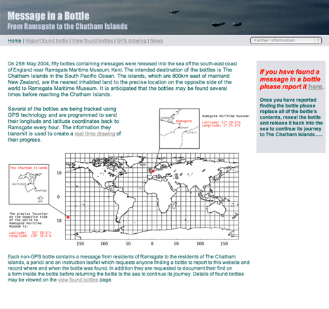
Message in a Bottle from Ramsgate to the Chatham Islands
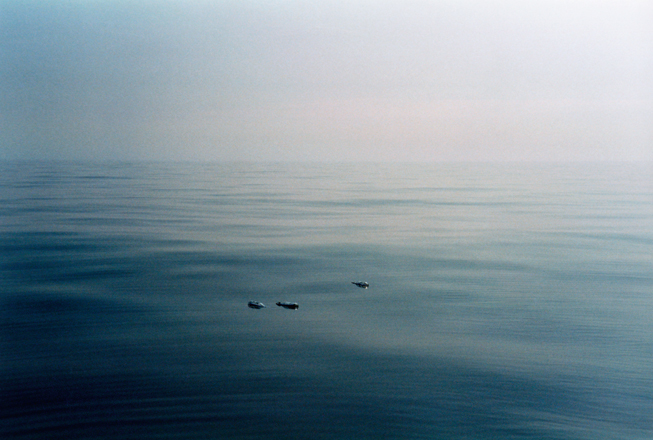
Message in a Bottle from Ramsgate to the Chatham Islands, 2004
Lambda C-type print mounted on aluminium
2003
2002
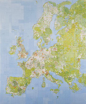
United European Union 2002, 2002
Collaged European road maps, collage in four parts, 41cms x 61cms each

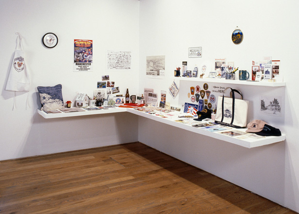
Souvenirs from Manchester
Souvenirs from Manchester is a collection of over 300 souvenirs, each emblazoned with the word 'Manchester', collected by the artist during a ten day journey by Greyhound bus to a selection of the forty-one places in the USA named Manchester.
The installation of souvenirs was commissioned by UMIM and exhibited in Fabrications at CUBE, Manchester, UK.
2001
Hemisphere Tracings (Northern Hemisphere, Southern Hemisphere), 2001
Ink on tracing paper, drawing in two parts 59cms x 59cms each
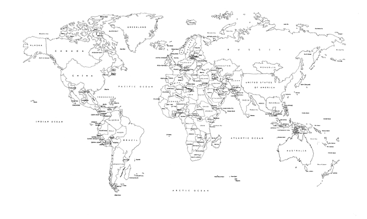
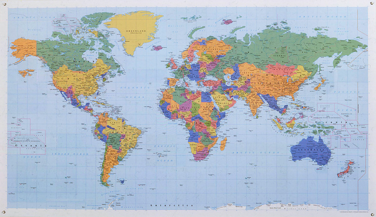
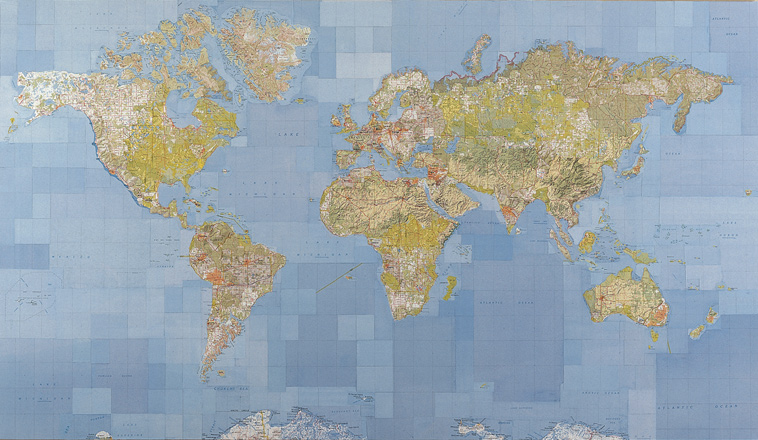
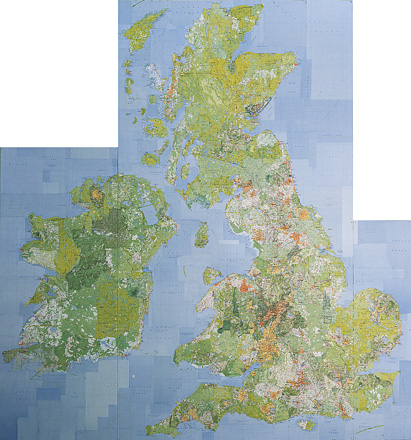
World Political Wall Map, 2001
Collaged world political maps (laminated with eyelets), 62cms x 97.5cms
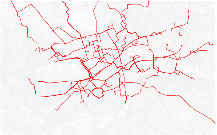
Cab Routes
One Week in London
Cab Routes One Week in London traces the routes made by cab driver Jason Brown as he ferried passengers across London during a specific week. Created before GPS navigation systems were commonplace in London taxis, the artists asked the cab driver to keep a record of his journeys using a red felt tip pen to draw onto photocopied maps of the city. The resulting lines are animated to create a one minute drawing.
Cab Routes One Week in London was commissioned by Cab Gallery - a project curated by Paul Stolper and Jason Brown.
2000
1999