2008
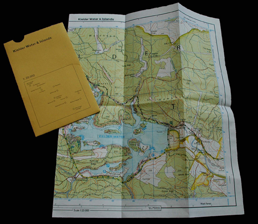
Kielder Water & Islands
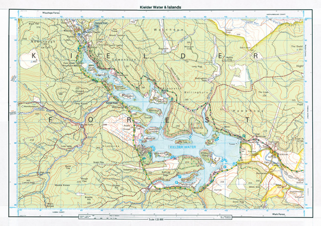
Kielder Water & Islands is a collaged map combining a contemporary map of Kielder Water with a map of the valley before it was dammed and flooded. On the new map a series of 'islands' are created from the 14 communities that existed before Kielder Water was opened in 1982.
Kielder Water & Islands was produced as an edition of 10,000 folded, printed maps with slipcase co-designed with Fraser Muggeridge studio and distributed free to visitors to Kielder Water & Forest Park.
Developed by The Kielder Partnership: The Calvert Trust, The Environment Agency, Forestry Commission, Northumberland County Council, Northumbrian Water, Tynedale Council & Community Groups.